Electric and Gas Utilities

GIS for Electric and Gas Utilities

Geospatial solutions provide you with the accurate information to plan your network effectively, stay compliant and respond to emergencies.

Talk to an expert

Utilities

Location Data Brings Value to Planning, Operations and Delivering a Positive Customer Experience

use geospatial data to mitigate electric outage

Utilities and energy companies have been using traditional GIS for network planning and mapping for years. What’s different today is the commercial availability of richly detailed data about people and places such as demographic data, building footprints and points of interest.

Combining this external location-based data with existing operational and network data can reveal trends and relationships that result in actionable information, or location intelligence. Analysis can be performed visually by overlaying this location-based data onto network maps, for example, or employing spatial analytics tools.

Read about geospatial for utilities »

How Energy and Gas Utilities Use Geospatial Data and Technology

Regulatory Compliance

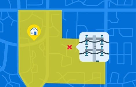
Every physical asset has a location and understanding the condition of those assets helps utility planners to set maintenance schedules and manage critical infrastructure to contain costs. Geospatial solutions help to map right-of-way, property boundaries, building locations and the impact of regulatory guidelines. Map clients to understand serviceability. View and process drone imagery to capture the condition of utility poles and transformers, and to make sure there is adequate separation between transmission lines for regulatory compliance.

Learn how to be regulatory »

Network Planning

Geospatial solutions help to prioritize network planning tasks and identify the optimum locations for the construction of new facilities. Monitor regions experiencing population growth to understand where to predict future infrastructure needs. Map current consumption and identify preventative maintenance areas where potential perils such as weather conditions or vegetation growth impact the network. Create dashboards for business unit managers that easily show the juxtaposition of network infrastructure to current construction or remediation projects.

Emergency Response

Create a common operational picture with a geospatial dashboard that shows the areas impacted by natural disasters thus allowing your senior staff to help them direct emergency personnel and assets. Collaborate, coordinate, and respond to real-time alerts, weather conditions, and other dynamic events. React faster during service interruptions to mitigate outages and restore service to customers. Monitor social media to pinpoint areas where customers are immediately impacted. Geospatial technology will help you to communicate with field personnel, map outages as well as connecting to SCADA systems.

Fleet & Workforce Management

Maximize the efficiency of your mobile workforce by optimizing the routing and scheduling of fleet vehicles thus minimizing vehicle maintenance and the carbon footprint. Plan and respond to emergencies by sending the personnel with the right skill set to the right location.

Customer Engagement

Citizens, as well as department managers, need access to the most up-to-date information about the network status. If disruptions, planned maintenances and outages occur, this information is best communicated visually in order to quickly assess the problem and deploy the right resources. A geospatial web mapping portal is an effective way to provide this information and with real-time information it can be immediately communicated to all stakeholders.

Statement Mailing

“Undeliverable As Addressed” mail costs are estimated at $20 billion per year or $3 per package according to the U.S. Postal Service. Make sure that customer billing statements, as well as regulatory information, arrive to the correct address, on time. Address management and high-precision geocoding solutions correct the problems associated with missing address data or mis-fielded information and validate for Coding Accuracy Support System (CASS) Certification.

Download this page (PDF)

Our utilities customers experienced a 50% reduction in labor and fuel costs by increasing their location data accuracy

Jean-Sébastien Turcotte

Vice President

Jean-Sébastien Turcotte

They trust our expertise

Ready to buy?

Our experts will send you a quote shortly.

Get a quote
CHATWITH US