Telecommunications

GIS for telecommunications

Use geospatial technologies to accelerate your network optimization and modernization initiatives.

Talk to an expert

Telecommunications

Monitor and Improve Your Network Performance

Geospatial technologies are no longer only used by GIS departments and RF Engineers but has become an important part of digital modernization of telecoms.

With the rise of new technologies such as 5G and IoT (Internet of things), the use of geospatial for telecommunication companies is expected to intensify and reach an unprecedented level of usage.

This will lead to a dramatic increase in data volumes, speed and processing capacity, as well as analysis complexity, putting pressure on existing capabilities and increasing the need for geoenrichment datasets.

Read more »

The Different GIS Applications
in Telecommunication

Network Planning

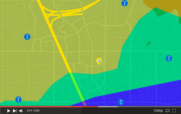
Geospatial solutions support the expansion of next generation wireless, fixed wireless, and wireline buildout. As the demand for data from connected devices expands, so does the need for broadband services capable of handing the immense volume of data. Innovation is a constant and so is the need to maintain a competitive position through efficient and effective planning. Visualize and analyze data to monitor network performance and workforce management.

Service Area Qualification

Telecommunication services vary widely by location. Certain broadband services are only available depending on the connectivity of the region. More accurate, verified coverage maps can now be produced using data directly received from mobile devices. To ensure that your sales and marketing teams are promoting services that can be delivered, geospatial solutions are used to identify service availability by subscriber location. Use premium geocoding technology to accurately pinpoint new and potential subscribers to provide them with accurate pricing.

Watch this webinar to learn more »

Emergency Response

During emergency situations, make sure your service team has the information it needs. Integrate data from sources that show where a natural disaster has occurred, get alerts from social media, government agencies and monitor weather conditions in near real-time. Improve overall network resiliency by visualizing your network assets and its real-time status. Dispatch field service teams with optimized route planning.

Customer Analytics

Data analytics in the telecom industry is important to continually engage with customers. That means keeping them informed about fast, reliable and expanded network coverage in both urban and rural areas, especially as advances in technology deliver improved voice and data services. As per a Nokia study, the main reasons, after price, for choosing an operator, are network quality and total network coverage. So let your customers know where and when they can expect services to be provided, and how information will be provided should services be interrupted. 

Fleet & Workforce Management

Deploy your workforce teams by optimizing routes so that you can maintain your infrastructure and reliably sustain service level agreements. Use a GIS software in telecommunication to maximize performance of your fleet and mobile workforce by monitoring traffic and weather patterns thereby reducing expenses, maintaining safety, and improving key performance indicators. 

Market Segmentation

To expand and grow the customer base, telecommunications providers need to find new retail locations near their target market. Geospatial technology can pinpoint additional opportunities for 5G subscribers and identify growth of wireless and Internet service customers to expand trade areas. Pre-provision with confidence while evaluating your marketing strategy and effectiveness, while keeping abreast of new competitors.

Statement Mailing

“Undeliverable As Addressed” mail costs are estimated at $20 billion per year or $3 per package according to the U.S. Postal Service. Make sure that customer statements, as well as promotional material, arrive to the correct address, on time. Address management and high-precision geocoding solutions correct the problems associated with missing address data or mis-fielded information and validate for Coding Accuracy Support System (CASS) Certification.

Tax Jurisdiction Assignment

Many counties and municipalities have complicated tax requirements by adding special purpose tax districts to collect additional taxes in very small geographies. So, how would telecommunication companies determine if they were collecting the proper taxes from consumers? Because of the different geographic limits of each district (e.g., municipality, school, tax increment financing district) there is a need for highly accurate and current map boundaries so taxes can be calculated correctly.

Download this page (PDF)

Korem’s developers are very capable and the staff understands our business needs. It’s not just about how cool a widget you can build; it’s about having the right widget at the right place at the right time. That’s what Korem understood and made valuable recommendations.

Lance Taylor

Senior Manager, Wireless Access Planning at Bell

read Bell's success story
Lance Taylor

They trust our expertise

Ready to buy?

Our experts will send you a quote shortly.

Get a quote
CHATWITH US