What is GIS?
October 23, 2024
How can we make better decisions using the geographic data around us? How do cities optimize infrastructure? How can businesses understand customer behavior through location data? How do we map out disasters to respond effectively?
For all those questions, Geographic Information Systems (GIS) hold the key. This powerful tool transforms spatial data into actionable insights, driving innovation across countless industries. Ready to discover how?
From risk assessment to site optimization, discover how GIS offers endless possibilities!
Definition of GIS
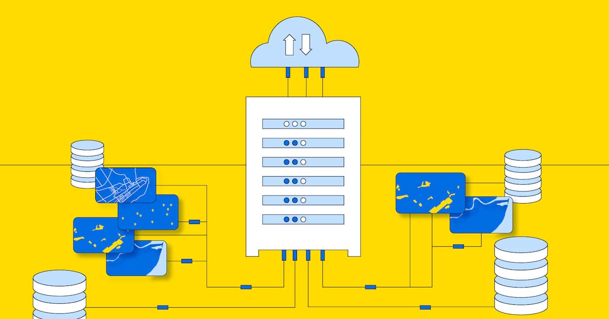
GIS is an abbreviation for geographic information systems and, more specifically, it is a computer software program that functions as a specialized tool for managing, visualizing, and analyzing location-based or geospatial data about people, places, and things on and under the Earth’s surface. The goal of using GIS is to arrive at a better understanding of the relationships between the very dynamic daily activities that occur on Earth by performing a geospatial analysis.
GIS has a close relationship to cartography, or the study of mapmaking, which seeks to represent objects on the Earth graphically, taking into consideration several unique characteristics about our planet. Fundamentally, maps show us objects on a 2-dimensional plane, like a piece of paper, that are present on a 3-dimensional surface, like the globe. Similarly, GIS uses the digital representations of these objects, and processes these data, accounting for the shape of the Earth.
The Key Components of GIS
A Geographic Information System (GIS) is built on several key components that work together to collect, analyze, and visualize spatial data. These elements include:
- Data Capture Systems:
GIS gathers data from sources like GPS, satellite imagery, and sensors, ensuring accurate spatial information for analysis.
- Spatial Data Analysis Tools:
These tools allow for complex analysis, such as measuring distances, identifying patterns, and overlaying multiple data layers.
- Visualization Tools (Maps and Layers):
GIS creates layered maps that help visualize relationships between different data sets, such as land use, population, and infrastructure.
- Geographic Databases:
A GIS database stores spatial and attribute data, enabling complex queries and data management for both geographic and non-spatial information.
- GIS Software:
GIS Software platforms like MapInfo Pro, Carto Platform, ArcGIS and QGIS provide the interface and tools for capturing, analyzing, and visualizing data.
- Hardware and Infrastructure:
GIS requires robust hardware, including servers, GPS devices, and computers, to process large datasets and deliver real-time results.
Each of these components is essential for transforming raw geographic data into actionable insights that inform decision-making and strategic planning across industries.
What are the uses of GIS?
Geographic Information Systems (GIS) offer a vast range of applications across numerous industries, providing critical insights for decision-making, analysis, and planning. Below are some of the key sectors where GIS plays an essential role:
- Business and Market Analysis:
Businesses use GIS for site selection, market analysis, and understanding customer behavior based on geographic data. It helps retailers determine optimal store locations, logistics companies improve route planning, and marketing teams target campaigns more effectively.
- Emergency and Disaster Management:
Emergency services depend on GIS for disaster preparedness, risk assessment, and coordinating responses to natural disasters. GIS is crucial for mapping high-risk zones, planning evacuation routes, and deploying resources during emergencies.
- Transportation and Logistics:
GIS optimizes logistics operations by improving route planning, reducing delivery times, and cutting costs. It also helps manage transportation networks, monitor vehicle fleets, manage EV charging strategy, and ensure efficient freight movement.
- Urban Planning and Infrastructure Development:
GIS helps city planners design more efficient infrastructure, manage zoning, optimize traffic flow, urban mobility, and allocate resources based on population growth and demand. It also aids in tracking the expansion of urban areas and planning for sustainable development.
- Environmental Management:
Environmental agencies rely on GIS to monitor deforestation, track wildlife movements, manage water resources, and predict natural disasters such as floods and wildfires. GIS also supports climate change studies by providing real-time data on environmental changes.
- Healthcare:
In the healthcare sector, GIS is used to track the spread of diseases, optimize the location of hospitals and clinics, and plan effective responses during public health emergencies. It also helps identify health trends and disparities across regions.
- Agriculture:
Farmers use GIS to monitor crop health, manage irrigation systems, and maximize land use. Precision agriculture benefits from GIS by enabling farmers to apply resources such as water and fertilizers more efficiently.
GIS is a transformative tool that turns vast amounts of geographic data into actionable intelligence. Its flexibility and precision make it indispensable across industries, driving innovation, efficiency, and sustainable practices worldwide.
Why is GIS important to businesses today?
To understand more about the functionality of GIS software and how a geospatial analysis is performed, you don’t need to have studied the applications of GIS. We “think spatially” every day and we regularly ask spatially-related questions all the time. For example, if you want to order pizza, your favorite pizza place will take your order online. Simply by obtaining your address, they will take into account your current position, the different locations of the closest restaurant franchise, and then deliver it to you in the fastest way possible!
From a business perspective, the vice president of real estate for a fast-food restaurant will ask his team to “find new store locations where the traffic counts are higher than the daily average between 10 AM and 2 PM, are located near street intersections, and that have the capacity to hold 50 parked cars.” This is a very routine spatial problem that can be answered by using the analytical querying capabilities of GIS.
Another form of location analysis involves the combination of tabular data with location data. For example, each country will routinely undertake a population census. The population count is generally assigned to an administrative boundary, such as a ZIP code or census tract. Census data is usually more than just a population count and may include information such as race, ethnicity, age, income, or education. Combining both the census data with boundary data provides the necessary elements to create a variety of “thematic” maps, useful to government policymakers and businesses alike. Each thematic map is usually represented by differing shades and colors for boundaries, lines or point locations. Boundaries, lines and points are referred to as geographic “primitives” as they are the building blocks of digital geographic data. Typical thematic maps include the ability to visualize the total population within a city or the average expenditure on clothing by ZIP code.
Who uses GIS?
GIS technology has evolved over its 50-year history to become an indispensable tool for businesses, government, non-profits, and others. There are a wide range of industries, using GIS software:
- Retailers use GIS to help locate sites for new stores.
- Insurance companies use GIS to support the underwriting and pricing of insurance policies.
- Banks use the technology to target new customers for credit cards or checking accounts.
- Transportation and logistics companies use the technology to route their fleets more efficiently.
- Utility companies leverage the location of “smart sensors” to track energy usage by neighborhood and mitigate outages from bad weather.
Governments also use the technology in a variety of ways from city planning to tax collection. Cities especially utilize GIS to plan for road repairs, remove snow after storms, pick up waste from streets or find the optimum location for schools. Public safety departments, both fire and police, use the technology to deploy resources according to the need to protect citizens from fire and crime, respectively.
The Benefits of Using GIS
Geographic Information Systems (GIS) offer a wide range of advantages that go beyond simple mapping. By combining spatial and descriptive data, GIS provides invaluable insights that help organizations make informed, data-driven decisions. Here are some key benefits of using GIS:
- Enhanced Decision-Making:
GIS allows decision-makers to visualize complex data through maps and other spatial representations. This helps identify patterns, trends, and relationships that might not be evident through traditional data analysis methods. GIS supports decision-making, for more precise and well-informed decisions.
- Improved Operational Efficiency:
GIS streamlines operations by optimizing workflows, resource allocation, and logistics. For example, companies can use GIS to plan efficient delivery routes, reduce travel time, and minimize fuel consumption, resulting in significant cost savings and increased productivity.
- Cost Savings:
By improving processes and minimizing inefficiencies, GIS can lead to substantial cost reductions. For example, GIS helps organizations solve problems related to unmailable documents, leading to better customer service and lower costs.
Furthermore, municipalities and retailers can reduce infrastructure costs through better planning.
- Better Risk Management:
GIS plays a crucial role in risk management and disaster assessment. By analyzing spatial data in real time, organizations in telecommunications, insurance and utilities can predict natural disasters, identify high-risk zones, and implement proactive measures to mitigate potential damage. It also helps coordinate emergency response efforts more effectively.
- Improved Customer Insights:
For businesses, GIS provides deeper insights into customer behavior based on location data. It helps companies understand market demographics, optimize store locations, and tailor marketing strategies to specific geographic areas. This leads to better customer targeting and increased revenue potential.
- Sustainability and Environmental Conservation:
GIS helps organizations manage and conserve natural resources more effectively. It aids in monitoring deforestation, tracking wildlife habitats, managing water supplies, and evaluating the impact of human activities on ecosystems. By providing detailed environmental data, GIS contributes to more sustainable practices.
How do I buy GIS software?
GIS is sold by many different vendors and is available as both a desktop and cloud-based solution, or software-as-a-service (SaaS). These options offer users a variety of ways to use the technology for either personal or company-wide applications. Geospatial data is growing rapidly and users can now find data marketplaces that provide extensive portfolios of products for use in every possible industry. See how to select the best GIS software for your needs.
Why work with Korem for geospatial services and as a GIS software provider?
While the availability of solutions is vast, many still consider it a technology that is not easy to use. Here, Korem provides strategic consulting and contract advisory services. As a value-added reseller, we offer an independent, agnostic viewpoint to help clients navigate the numerous possibilities of geospatial information solutions.
At Korem, we understand that navigating the world of geospatial information solutions can be overwhelming. That’s why our team is dedicated to providing expert guidance, ensuring you select the right GIS solution tailored to your specific needs. Contact us today to discover our geospatial solutions, how we can transform your geospatial data into actionable insights and drive meaningful results for your organization.
Discover our geospatial solutions »
