Let’s Look at The Latest Update For Precisely MapInfo Pro (V2021)
October 4, 2021
With its previous MapInfo Pro update (v2019.3), Precisely was looking to improve its product with better all-around capabilities such as improved LiDAR data support, more flexibility in data processing with Python, and improving the user experience (UX) with better visualization of heatmaps. At the same time, the MapInfo Marketplace was launched. With its new version, the enhancement trend continues with many improvements that will, without a doubt, be welcomed by current users as well as newcomers that are either looking to start their journey utilizing geospatial technology or those in the market for an alternative to their current GIS software.
Here’s a list of some of the new, key features:
- Time series capabilities
- “Select by Attribute” tool
- Expanded GDAL file format support
- Tiled Server reprojection
- Multi-Resolution Virtual Raster (MVR)
- Support for paging in WFS
Everything changes with time
How many times have you consulted or analyzed data with a time component and told yourself: “It would be nice to easily visualize the evolution and changes of my data by time.” The wait is over because Precisely has introduced new “time series capabilities.”
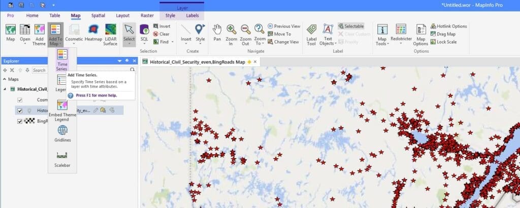
The “Layer Time Properties” gives you the opportunity to select different time configurations, depending on how your table is structured. Once you’ve selected the appropriate time configuration, you can determine the time frame extent of the data that you want to analyze or visualize. In addition, you can choose how you want to aggregate the data based on the period length within the time frame. Once the properties are determined, you have access to a whole new set of tools, like sequence visualization, among others. This tool enables users to observe the changes to data over each time horizon as if they were watching a video.

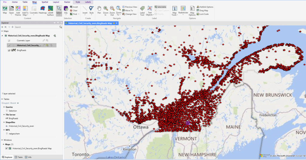
These new capabilities will be very useful for people who want to identify new trends through their data and see how they change in time and space. They will also be able to export and share this new type of visualization.
Another option to make the right selection
In previous versions of MapInfo, the user-friendly interface used to create a spatial query required some knowledge of structured query language (SQL). Knowing that not every GIS user is completely familiar with SQL syntax and structure, the new “Select by Attribute” tool introduces a new way to manipulate data for browsing, visualization or exporting. This new type of selection tool is based on operators that you determine for one or more fields from within your data table. The tool is designed so that you can easily define the conditions of the query without thinking about syntax or query structure like you would with a traditional SQL query.
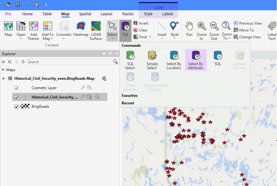
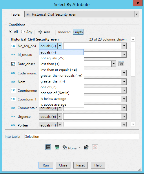
We can see similarities between this new tool and the functionality for filtering we usually see in spreadsheets. With that in mind, MapInfo Pro has taken another step to support new users who are less familiar with database and GIS language.
Diversity and flexibility give you possibilities!
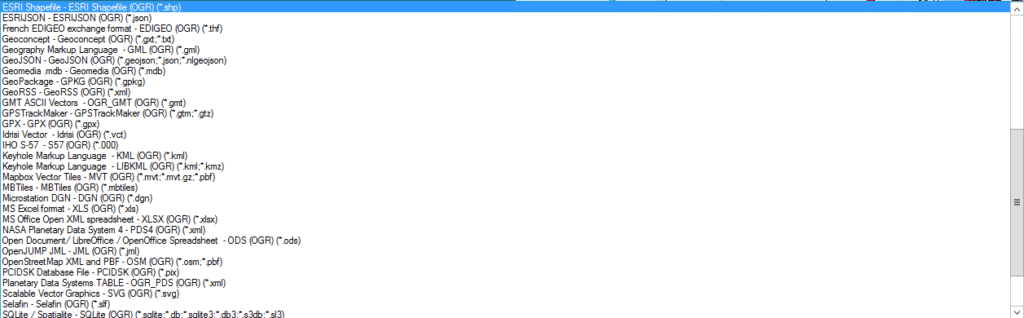
In the last few years, geospatial software applications have taken an extraordinary leap in functionality. As a result, new solutions and standards have emerged, especially with the increase in popularity of open-source software. With its new release of MapInfo Pro, Precisely did exactly what was needed to keep pace with this new competitive reality. It is now possible to access and use dozens of new file formats, mostly aligned with GDAL/OGR formats. Among the most useful and popular of these supported file formats are GeoJSON, KML, GML and vector tiles. Here is a sneak peek of the supported file formats: