Geospatial Expertise: An Undeniable Facilitator for Operational Monitoring of Sustainable Development Goals
March 14, 2022
Successive reports by the Intergovernmental Panel on Climate Change (IPCC) clearly highlight the major impacts of human activities on climate change and, more broadly, on the resolution of major global dynamics. The scale of these changes, and especially their acceleration, is such that they would constitute a new geological force capable of affecting the Earth’s ecosystem and causing significant imbalances.
In keeping with the Millennium Development Goals, United Nations Member States adopted, in 2015, after two years of negotiations, 17 Sustainable Development Goals (SDGs), under the umbrella of Agenda 2030 (Fig. 1). The Sustainable Development Goals propose 1691 target goals, common to all involved states, to be reached by 2030. The SDGs are built around the world’s great challenges, offering more inclusive leverage and perspectives, such as eradicating poverty in all its forms and in all countries, protecting the planet, and ensuring prosperity for all. Together, they correspond to the three pillars of sustainable development.
As long as the SDGs remain poorly understood by the public, the difficulties in locally implementing these rather “macro” goals remain considerable, despite the recent United Nations deployment of a series of simple actions, including a mobile application and even a chatbot for the general public.
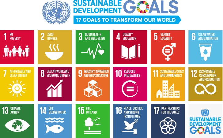
Fig.1 — The 17 Sustainable Development Goals (Source: United Nations)
Geospatial Data at the Heart of Sustainable Development Goals
In the matter of SDG implementation and monitoring scales, geospatial data and expertise play a key role. When viewed up close, most of the SDGs and their associated targets are of a spatial or minimal nature and require a geographical perspective to be effectively understood. On at least two levels, geospatial expertise is an essential lever for the operational monitoring of sustainable development goals.
Multi-Scalar Integration
Geospatial data challenges are twofold here: the availability of quality data and the integration of multi-source and multi-scale data (matching). Of course, raster data (imagery, lidar, etc.) are immediately necessary when it comes to monitoring continuous spatial phenomena, particularly on a small scale (weather, air quality, atmospheric pollution, but also marine resources and currents, or even fires, heat islands and floods). On this last theme, the team of Karem Chokmani, professor of remote sensing and hydrology at INRS, designed and developed the geospatial technology associated with E-NUNDATION, an innovative method to simplify and facilitate access to “information generated by hydrological and hydraulic models” for flood risk managers at different levels of government (state, region, municipalities, cities, communities, etc.). This technology is now being disseminated by the company Geosapiens, which is being incubated by INRS. Geosapiens offers a well-positioned geospatial service in the insurance sector, allowing it to produce models for assessing flood risks on the population and infrastructure for example.
Combinations of vector and geostatistical data are also essential means of multi-scalar monitoring. In this regard, the ecosystem of Korem partners (Environics Analytics, Foursquare, HERE Technologies, and Precisely) offers a variety of very rich data, such as parcel, statistical, demographic, segmentation, consumption, and location data (e.g., points of interest). These data are capable of feeding SDG monitoring indicators at different geographical scales and of characterizing the targets: transport and flows, mobility and health, responsible consumption, economic growth, spatial justice, etc. (Fig. 2).
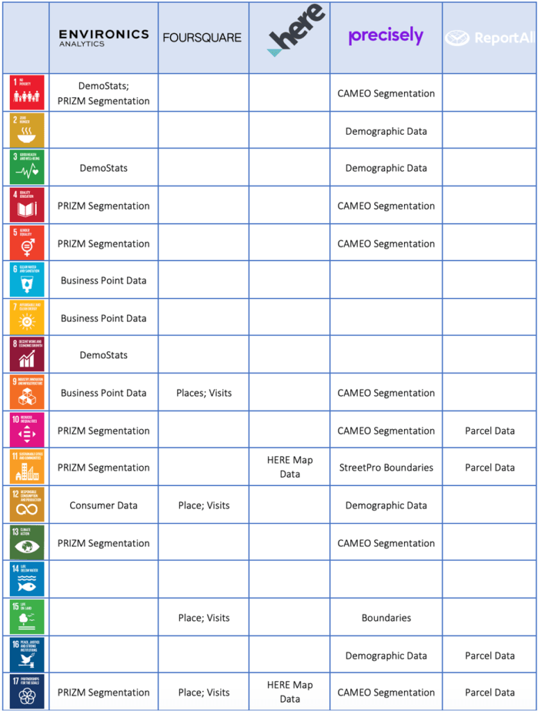
Fig.2 — Data ecosystem of Korem and SDGs
Mapping of Monitoring Indicators
The United Nations recently published 17 maps for 17 goals that illustrate, for each of the SDGs, the relevance of key indicator map monitoring. These illustrations continue the enormous work produced by a team of the International Cartographic Association (ICA) in collaboration with the United Nations in the context of Mapping for a sustainable world.
Building target monitoring indicators by multivariate aggregation, clustering, and spatially constrained classification is certainly among the most useful methods for monitoring the SDGs at local scales (large scales) while maintaining the possibility of a coherent perspective at more macro scales (small scales). This is one of the main objectives of the Canadian Observatory on Local Governance of the SDGs project, which is being carried out by the Institute of Environment, Development, and Society (EDS) of Laval University and funded by the federal government (Fig. 3). This project is consistent with the work already done in Winnipeg by the International Institute for Sustainable Development, particularly the design of Tracking progress, a tool dedicated to mobilizing local data for SDG implementation.
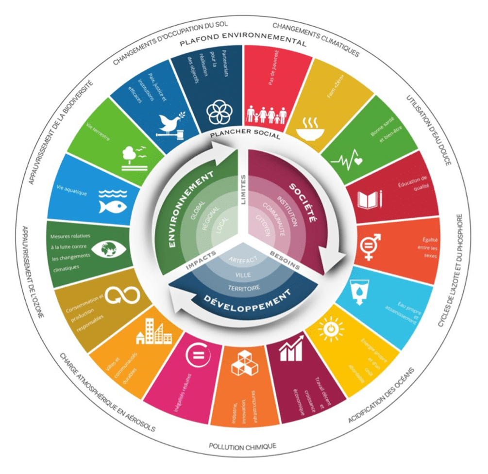
Fig.3 — SDG Observatory Framework (Source: EDS Institute)
Quebec Geospatial Companies are Leading the Way
A decade ago, the Bureau de normalisation du Québec published standard BNQ 21,000 to encourage and facilitate Quebec organizations to consider and apply the principles of the Sustainable Development Act. The associated BNQ 21,000 Method offers the tools necessary for the implementation of a culture of sustainable development. BNQ 21,000 is based in particular on the mapping of 21 main “micro” business issues (vision, mission, and value; business ethics; governance; working conditions; health and safety; etc.) with the 16 “macro” principles (health and quality of life; solidarity and equity; access to knowledge; prevention; precaution; responsible production and consumption; preservation of biodiversity; etc.) of the Sustainable Development Act, based on RIO 1992. Work is being done in collaboration with a team of researchers at The University of Sherbrooke to update BNQ 21,000, this time associating business issues with the 17 SDGs.
In this context, Korem acts on two levels.
First, from an entrepreneurial point of view: Korem places social responsibility at the heart of its mission and actions. Community involvement and philanthropic engagement, as well as an explicit commitment to equity, diversity, and inclusion, are core values of the company. Korem is also committed to minimizing its environmental footprint and is committed to promoting digital sobriety. All employees are mobilized daily by taking ecological, fair, and sustainable actions. Korem took advantage of the current pandemic context not only to thoroughly rethink working arrangements, work-family reconciliation, and the ecological cost of travel but also to redesign and reorganize all its workspaces according to new uses in a post-COVID perspective to consider the new realities (teleworking, hybrid mode, mobility, etc.).
Second, it has also acted from the point of view of its mandates, particularly in the fields of transport, retail, and energy, in which Korem deploys its range of geospatial expertise and products in a sustainable perspective, aware of the importance of articulating economic prosperity, social justice, and respect for the environment. The example of the mandate carried out for St-Hubert Rotisseries Ltd. shortly before the pandemic is significant. Thanks to the migration of its online ordering platform to a new cloud-based geolocation solution, St-Hubert has been able to increase its match rate to 96% on the Web and has had no performance issues ever since. In doing so, not only did the St-Hubert Rotisseries significantly improve their customer service to cope with the impact of the pandemic, but it was also able to optimize the movement of its delivery vehicles (optimizing routes, eliminating delivery errors, etc.). This is no small accomplishment, as Saint-Hubert is investing precisely in order to ensure the carbon neutrality of its operations.
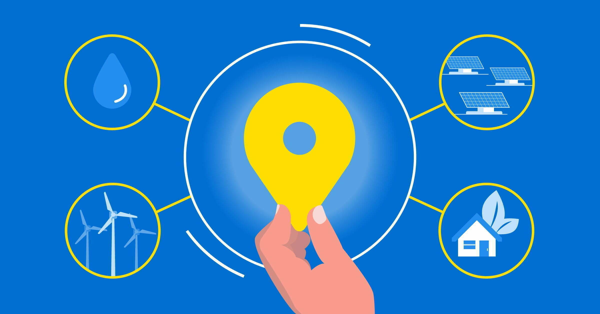
Take a Little More Geospatial Approach in Your SDGs
The 17 Sustainable Development Goals (SDGs) and the 169 associated targets constitute a call for action by all UN member states to promote prosperous and equitable development while protecting the planet and its ecosystems. Many targets are directly or indirectly linked to sectors and areas of activity in which geospatial expertise is an essential ingredient: transportation, energy, development, economic development, etc. It is therefore not only important that all players in the geospatial field consider the SDGs in their practice, but also that decision-makers and managers, whatever their level of responsibility, consider a little geospatial approach in their SDGs.
